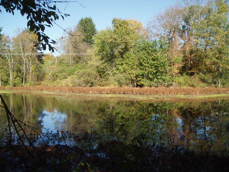
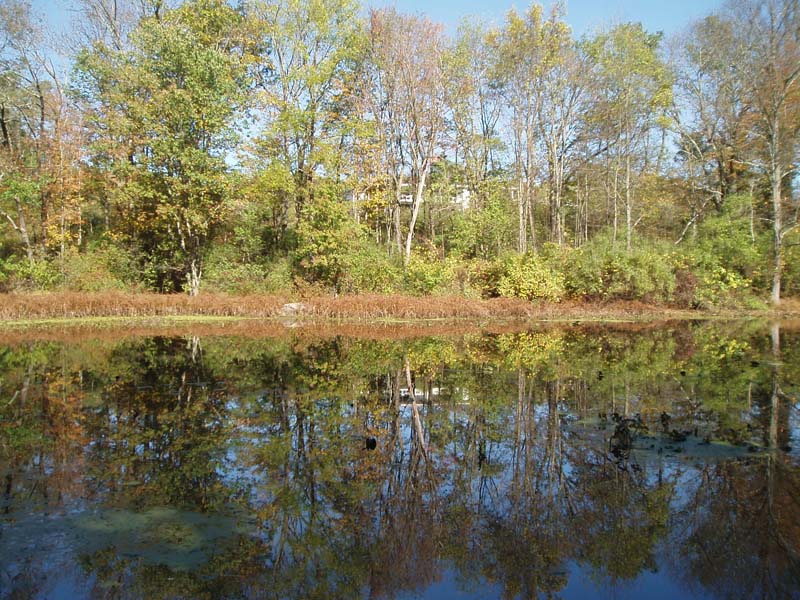
 Water-willow (Decodon verticillatus) Shrub Wetland
System: PalustrineSubsystem: Shrubland
PA Ecological Group(s): Basin Wetland
Global Rank: GNR
![]() rank interpretation
rank interpretation
State Rank: S3
General Description
Water-willow (Decodon verticillatus) has the ability to extend itself laterally over open water and thus forms a fringe along the aquatic edge of lakeside, creekside, or bog-lake-side wetlands. The associated species vary widely; some common examples are spatterdock (Nuphar advena/ N. variegata), arrow-arum (Peltandra virginica), pickerel-weed (Pontederia cordata), bladderworts (Utricularia spp.), and buttonbush (Cephalanthus occidentalis). This community type may occur as part of the acidic glacial peatland complex.
Rank Justification
Uncommon but not rare; some cause for long-term concern due to declines or other factors.
Identification
- May occur as part of a complex and usually on fringes of lakes, bogs, and waterways.
- Mucky substrate
- Clear dominance of water-willow (Decodon verticillatus)
Characteristic Species*
Shrubs
Herbs
- Spatterdock (Nuphar advena)
- Spatterdock (Nuphar variegata)
- Pickerel-weed (Pontederia cordata)
- Bladderworts (Utricularia spp.)
*Vascular plant nomenclature follows Rhoads and Block (2007). Bryophyte nomenclature follows Crum and Anderson (1981).
International Vegetation Classification Associations:
Swamp-loosestrife Shrub Swamp (CEGL005089)
NatureServe Ecological Systems:
Northern Atlantic Coastal Plain Stream and River (CES203.070)
Northern Atlantic Coastal Plain Fresh and Oligohaline Tidal Marsh (CES203.516)
Northern Atlantic Coastal Plain Pond (CES203.518)
Origin of Concept
Zimmerman, E., and G. Podniesinski. 2008. Classification, Assessment and Protection of Floodplain Wetlands of the Ohio Drainage. Pennsylvania Natural Heritage Program, Western Pennsylvania Conservancy, Pittsburgh, PA. Report to: The United States Environmental Protection Agency and the Pennsylvania Department of Conservation and Natural Resources, Office of Conservation Science. US EPA Wetlands Protection State Development Grant no. CD-973081-01-0.
Pennsylvania Community Code*
SW : Water-Willow (Decodon Verticillatus) Shrub Wetland
*(DCNR 1999, Stone 2006)
Similar Ecological Communities
Buttonbush Wetland and Water-willow Shrub Wetland occur in similar environmental settings and both contain buttonbush (Cephalanthus occidentalis), but unlike the Buttonbush Wetland, it is not the clear dominant shrub species.
Fike Crosswalk
Water-willow (Decodon verticillatus) Shrub Wetland
Conservation Value
This community serves as a buffer for sediment and pollution runoff from adjacent developed lands by slowing the flow of surficial water causing sediment to settle within this wetland. Water-willow (Decodon verticillatus) can also be an aggressive competitor and can degrade peatland habitats, especially where bog pools and ponds are present.
Threats
While impoundments and hydrological alteration of free flowing streams often facilitated development of this community in many areas, continued changes to site hydrology may impact this community (e.g., impoundments, beaver dams) and lead to shifts in community function and dynamics. Clearing and development of adjacent land can lead to an accumulation of agricultural run-off and pollution, sedimentation, and insolation/thermal pollution. Invasive plant species such as purple loosestrife (Lythrum salicaria) and common reed (Phragmites australis ssp. australis) can dominate this community.
Management
A natural buffer around the wetland should be maintained in order to minimize nutrient runoff, pollution, and sedimentation. The potential for soil erosion based on soil texture, condition of the adjacent vegetation (mature forests vs. clearcuts), and the topography of the surrounding area (i.e., degree of slope) should be considered when establishing buffers. The buffer size should be increased if soils are erodible, adjacent vegetation has been logged, and the topography is steep as such factors could contribute to increased sedimentation and nutrient pollution. Direct impacts and habitat alteration should be avoided (e.g., roads, trails, filling of wetlands) and low impact alternatives (e.g., elevated footpaths, boardwalks, bridges) should be utilized in situations where accessing the wetland can not be avoided. Care should also be taken to control and prevent the spread of invasive species within the wetland.
Research Needs
Variations may occur at ecoregional levels. There is a need to collect plot data to characterize variations of this community.
Trends
Shrub wetlands were probably more common but declined due to dam impoundments, wetland draining/filling, and clearing of the adjacent lands and subsequent sedimentation. Wetland protection has most likely stabilized the decline of these communities. The relative trend for this community is likely stable or may be declining slightly due to hydrological alterations.
Range Map
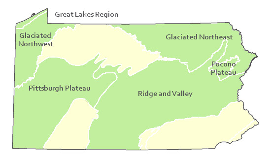
Pennsylvania Range
Glaciated Northeast, Glaciated Northwest, Great Lakes Region, Pocono Plateau, Ridge and Valley, and the Pittsburgh Plateau
Global Distribution
Connecticut, Delaware, Massachusetts, Maryland, New Hampshire, New Jersey, New York, Pennsylvania, Vermont, and West Virginia. The community also occurs in Canada in Ontario and Quebec.
Pennsylvania Department of Conservation and Natural Resources (DCNR). 1999. Inventory Manual of Procedure. For the Fourth State Forest Management Plan. Pennsylvania Bureau of Forestry, Division of Forest Advisory Service.- Harrisburg, PA. 51 ppg.
Stone, B., D. Gustafson, and B. Jones. 2006 (revised). Manual of Procedure for State Game Land Cover Typing.- Commonwealth of Pennsylvania Game Commission, Bureau of Wildlife Habitat Management, Forest Inventory and Analysis Section, Forestry Division.- Harrisburg, PA. 79 ppg.
